Mannar
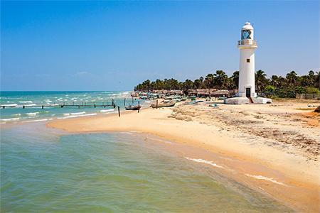
Mannar is a sandy island that is connected to the main island by a causeway.
Adam’s Bridge is located to the north of the island. A 48-kilometer-long natural path connects India’s Pambalm island to Sri Lanka’s Mannar island via a succession of limestone shoals and dunes. The Sri Lankan end of the bridge has been designated as the Adam’s Bridge National Park, with an area of 18990ha. According to geological data and records discovered, the bridge was formerly a land connection between the two nations and could be crossed on foot until storms deepened the canals in 1480.
It is a marine conservation area where a variety of fish and aquatic grasses may be found.
Mannar is an excellent location for kite surfing.
Additional information
Nearby Attractions
- Shrine of Our Lady of Madhu
The Site of Our Lady of Madhu is considered Sri Lanka’s holiest Catholic shrine, drawing people from all around the island. The temple has a history that dates back more than 400 years. However, the church that can be seen now was completed in 1872.
Distance: 49 Km
- The Doric at Arippu
It was erected between 1801 and 1804 as the residence of the first British Governor of Ceylon. In the meanwhile, he used the place to revitalize and monitor the pearl fisheries.
The architectural design of the columns, which was comparable to the Ancient Greek Doric order style, led to the structure being dubbed ‘The Doric.’
Distance: 37 Km
- Baobab Tree
The famous baobab tree reaches 7.5 meters tall and has a circumference of 19.5 meters. Because their branches imitate roots, baobab trees are known as upside-down trees in Africa, where they are native. It was brought to Sri Lanka by ancient Arab traders and is known as Ali Gaha or Elephant Tree in Sri Lanka because of its thick bark that resembles elephant skin.
It is one of approximately 40 remaining baobab trees in the country, all of which are protected due to the species’ rarity.
Distance: 2 Km
- Mannar Fort
The Portuguese erected the fortification with four bastions in 1520. The fort was conquered by the Dutch in 1658 after the constant battle from the Portuguese, but no substantial changes were made to the fort other than fortifying it. Following the capitulation of the Dutch, the British captured the fort in 1795.
Distance: 700m
- Adam’s Bridge Marine National Park
Adam’s Bridge is a 48-kilometer-long stretch of limestone shoals and dunes that connects India and Sri Lanka.
This marine conservation area is home to dolphins, dugongs, and turtles. The region serves as a rest stop and nesting area for migrating birds that visit Sri Lanka.
Distance: 33 Km
- Mannar Bird Sanctuary
The sanctuary is a blessing in disguise for the environment and wildlife enthusiasts who want to see a wide diversity of migratory and local birds.
During the migratory season, the park provides superb feeding and living habitat for over 20000 waterbirds, as well as rare birds such as the spot-billed duck, comb duck, long-toed stint, peregrine falcons, and the extremely rare Eastern Black-tailed Godwit. Nearly 150 different bird species have been observed in the area.
Distance: 26 Km
- Thiruketheeswaran Hindu Temple
This Hindu Temple, devoted to the Hindu deity Shiva, is one of the most venerated Hindu Temples in Sri Lanka.
There is no trace of the temple’s beginnings, although it has the earliest reference of the 6th century BC and was renovated as recently as 1903 AD. The temple was thereafter given various facelifts and extensions till the 1970s.
Distance: 6.5 Km
The most popular nearby attraction: Mannr Bird Sanctuary (26 Km)
Accommodation
within 10 Km
Star Classified Hotels- Yes
Boutique Hotels- No
Resorts- No
International Chain Hotels- No
Ayurvedic Hotels- No
Villas- No
Eco Hotels- No
Camping- No
Unclassified Hotels- Yes
* You might still find preferred accommodation in nearby cities.
Distance
CMB Airport- 262 Km (travel time: 5hrs 30min)
Colombo City- 324 Km (travel time: 6hrs)
Sigiriya Rock Fortress- 172 Km (travel time: 3hrs 30min)
Anuradhapura Ancient City- 112 Km (travel time: 2hrs 20min)
Polonnaruwa Ancient City- 200 Km (travel time: 3hrs 50min)
Kandy City- 237 Km (travel time: 4hrs 50min)
Galle Dutch Fort- 420 Km (travel time: 7hrs 10min)
* The time and distance are only given to give you an idea. There are stopovers between the two locations. The cities listed above are some of the most popular tourist attractions in Sri Lanka.
Best Time
May to September
Weather
https://www.weather-atlas.com/en/sri-lanka